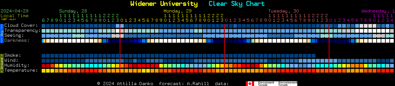
The Clear Sky Clock graphic above uses models from Environment Canada.
Here is the
cloud forecast for tonight.
Click the "Play" button to run
the animation.
The number with a "Z" in the header of each frame is
the UTC, e.g. "22Z" means 22:00 UTC, which is 18:00 EDT / 17:00 EST.
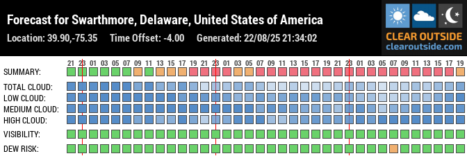
Cloud models for the next twelve hours from UCAR.
(Times are in Universal time [essentially GMT] so to get
our local time, subtract 5 hours during standard
time, 4 hours during daylight savings time.)
National Weather Service forecast:
Satellite IR loop for BWI (or this non-java version).
Satellite visible loop for BWI (or non-java version).
Phillywx.com, comprehensive local weather commentary (especially good for focused forecasts of winter storms with more local nuance).